
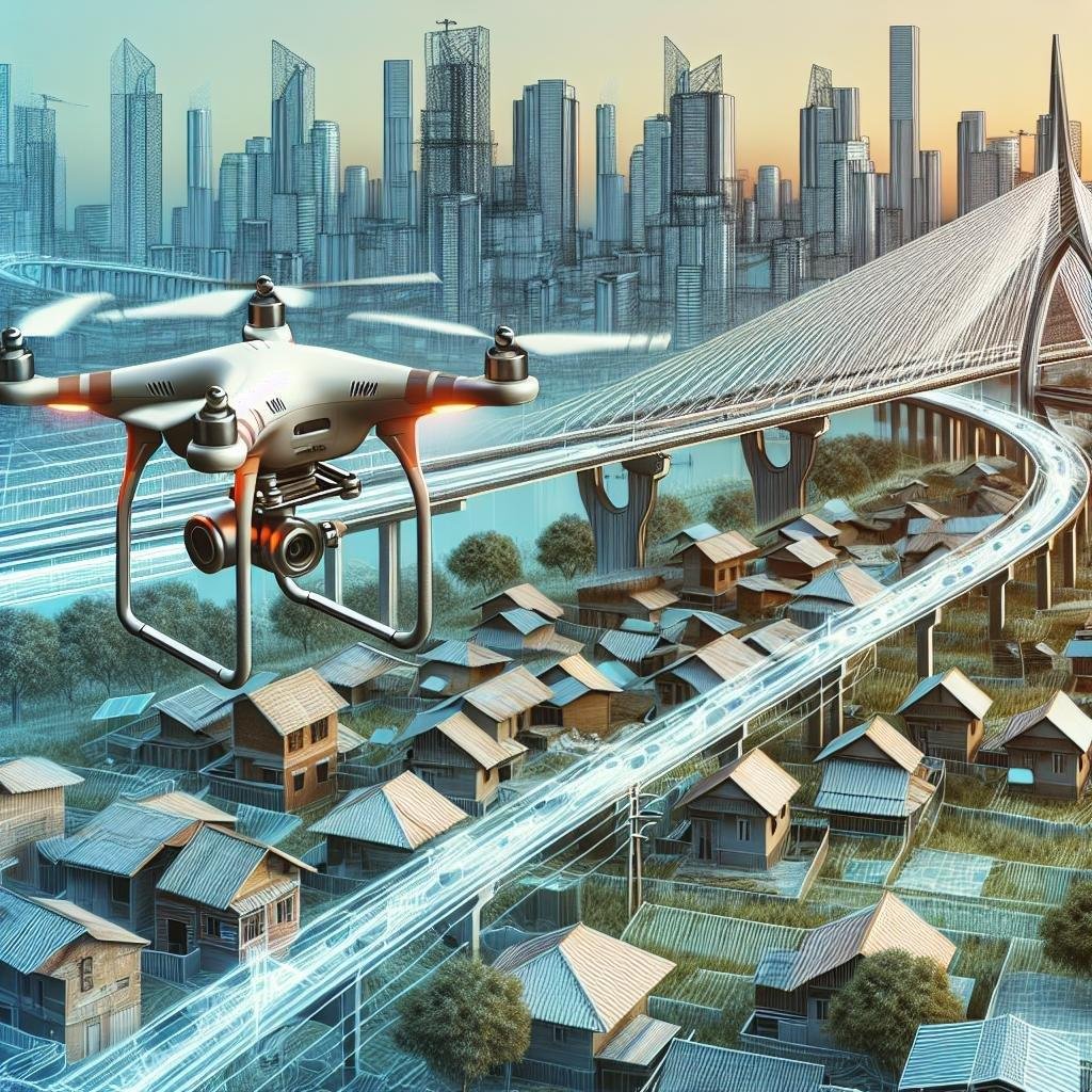
In an age where technology continues to transcend boundaries and reimagine possibilities, the way we approach infrastructure and building inspections is no exception. Once an arduous task limited by human accessibility and fraught with safety concerns, the inspection landscape is now being revolutionized by the rise of drones. These aerial marvels have become the eyes in the sky, offering unparalleled precision, efficiency, and safety. Welcome to our guide on the top drones for inspecting infrastructure and buildings, where we delve into the cutting-edge technologies that are transforming skylines and structures alike. Whether you’re an industry professional or simply a tech enthusiast, prepare to be enlightened by the advancements that are propelling us to new heights.
Understanding Key Features for Structural Inspections
Successful structural inspections rely on drones equipped with key features that enhance precision and safety while reducing time and cost. High-resolution cameras are paramount, allowing inspectors to capture clear and detailed images of critical infrastructure components. Obstacle avoidance technology ensures that the drone can operate safely in complex environments, minimizing the risk of crashes in hard-to-reach areas. Furthermore, thermal imaging capabilities provide invaluable insights by detecting heat anomalies that might indicate insulation issues or hidden structural damages.
Another vital feature is GPS mapping and geotagging, which helps in accurately documenting and revisiting inspection sites. Long battery life is crucial for covering extensive areas without frequent recharges, ensuring efficient inspections. Additionally, drones with automated flight modes and pre-programmed routes can systematically scan large structures, offering comprehensive coverage. Other notable features include real-time data transmission for instant analysis and robust durability, ensuring the drone operates reliably in diverse weather conditions.
| Feature | Importance |
|---|---|
| High-resolution cameras | Critical for clear imagery |
| Obstacle avoidance | Ensures operational safety |
| Thermal imaging | Detects hidden damages |
| GPS mapping | Accurate site documentation |
| Long battery life | Essential for extended inspections |

Leading Drone Models for Infrastructure Assessment
When it comes to assessing the structural integrity of buildings and infrastructure, several drone models stand out for their cutting-edge technology and reliable performance. DJI Matrice 300 RTK is a top choice for professionals in the field. With its advanced dual-camera system and real-time kinematic (RTK) accuracy, this model is perfect for detailed inspections and high-precision mapping. Parrot Anafi USA is another excellent option, featuring thermal imaging and 32x zoom capabilities, making it highly effective for identifying weaknesses in large structures or hard-to-reach places.
| Drone Model | Key Feature | Application |
|---|---|---|
| DJI Matrice 300 RTK | Dual-camera system with RTK | High-precision mapping |
| Parrot Anafi USA | Thermal imaging, 32x zoom | Identifying structural weaknesses |
For professionals looking for a more compact solution without compromising on performance, the Autel Robotics EVO II series offers an excellent blend of portability and advanced features. The EVO II Dual 640T model includes a high-resolution thermal camera, making it ideal for infrastructure maintenance and repair assessments. Another noteworthy mention is the Skydio 2, known for its superior obstacle avoidance technology and autonomy, allowing it to navigate complex environments while capturing high-quality images and videos. This makes it uniquely suited for detailed structural inspections and monitoring.

Optimizing Building Surveys with Advanced UAV Technology
When it comes to inspecting infrastructure and buildings, leveraging advanced UAV technology can dramatically enhance the efficiency and accuracy of your surveys. Some of the top drones in this category feature advanced imaging capabilities, extended flight times, and robust obstacle avoidance systems. Notably, the DJI Matrice 300 RTK stands out with its impressive 55-minute flight time and exceptional thermal imaging. Equally compelling is the Parrot Anafi USA, which offers 32x zoom capability and an IP53 rating, ensuring reliability in various weather conditions.
Other noteworthy options include the SenseFly eBee X, renowned for its rugged design and precise data collection, and the Skydio 2, which excels in autonomous navigation through complex environments. Here are some key features to look out for when selecting a drone for building surveys:
- High-Resolution Cameras: For detailed inspections.
- Thermal Imaging: Identifying heat leaks and insulation faults.
- Extended Flight Time: Ensuring comprehensive surveys without frequent recharging.
- Obstacle Avoidance: Safeguarding the drone during close inspections.
| Drone Model | Key Feature | Flight Time | Special Capability |
|---|---|---|---|
| DJI Matrice 300 RTK | Thermal Imaging | 55 minutes | RTK Precision |
| Parrot Anafi USA | 32x Zoom | 32 minutes | All-weather Reliability |
| SenseFly eBee X | Rugged Design | 90 minutes | High Accuracy Data |
| Skydio 2 | Autonomous Navigation | 23 minutes | Complex Environment Adaptability |

Real-World Applications and Success Stories
From civil engineers ensuring the structural integrity of bridges to facility managers overseeing the maintenance of skyscrapers, drones have revolutionized infrastructure inspections. These high-tech devices offer unparalleled access to hard-to-reach places, delivering high-resolution imagery and comprehensive data without the need for expensive and time-consuming scaffolding. A prominent success story comes from the Golden Gate Bridge, where drones equipped with thermal imaging cameras were used to identify corrosion and other potential structural issues, drastically reducing the inspection time and cutting costs by almost 50% compared to traditional methods.
Many municipalities around the world are also leveraging drone technology to improve public safety and efficiency. For instance, major cities like Chicago and London have utilized drones to inspect and monitor the conditions of their aging sewer systems, and to survey damage after natural disasters. Key benefits include:
- Enhanced Safety: Eliminates the need for manual checks in hazardous areas.
- Cost-Efficiency: Reduces reliance on labor-intensive methods like scaffolding and cranes.
- Data Accuracy: Provides high-quality visuals and precise data measurements.
| Project | Location | Outcome |
|---|---|---|
| Golden Gate Bridge Inspection | San Francisco, USA | Reduced inspection time and costs by 50% |
| Flood Damage Assessment | Bangkok, Thailand | Swift identification of affected areas |
| Sewer System Monitoring | Chicago, USA | Enhanced public safety and efficiency |
Q&A
Q&A: Top Drones for Inspecting Infrastructure and Buildings
Q1: What makes a drone suitable for inspecting infrastructure and buildings?
A1: A drone suitable for inspecting infrastructure and buildings typically boasts robust features such as high-resolution cameras, thermal imaging capabilities, and extended flight times. Additionally, stability in adverse weather conditions, precise GPS systems, and advanced obstacle avoidance technology are crucial. These features ensure detailed inspections, accurate data collection, and enhanced safety for operators.
Q2: Which drones are currently leading the market for these types of inspections?
A2: Industry leaders include the DJI Matrice 300 RTK, Parrot ANAFI USA, and the Skydio X2. The DJI Matrice 300 RTK is renowned for its powerful imaging system and long flight duration, while the Parrot ANAFI USA offers thermal vision and 32x zoom capabilities. The Skydio X2 stands out for its autonomous navigation and robust obstacle avoidance, making it a reliable choice for intricate inspection tasks.
Q3: How does the DJI Matrice 300 RTK set itself apart from competitors?
A3: The DJI Matrice 300 RTK excels with its advanced AI capabilities, dual-camera setup featuring both visual and thermal sensors, and an impressive flight time of up to 55 minutes. It also includes a precise RTK positioning system, which enhances its stability and accuracy, particularly for complex inspections and data collection tasks.
Q4: What unique features does the Parrot ANAFI USA offer for inspection purposes?
A4: The Parrot ANAFI USA stands out with its military-grade durability and compact design, making it highly portable. Its 32x zoom camera facilitates detailed visual inspections, while the integrated thermal imaging is invaluable for identifying heat leaks or overheated components. Moreover, its lightweight frame allows for agile maneuverability in tight spaces.
Q5: Why might an inspection team choose the Skydio X2 over other drones?
A5: The Skydio X2 is favored for its unparalleled autonomous navigation system, powered by six 4K navigation cameras that provide a 360° view for superior obstacle avoidance. This makes it particularly effective in challenging environments where manual piloting is difficult. Its rugged build and thermal imaging capabilities also add to its appeal for thorough inspection tasks.
Q6: Are there any emerging trends or technologies in drone inspections that professionals should be aware of?
A6: Emerging trends include the integration of AI and machine learning for real-time data analysis, drone swarms for faster and more comprehensive inspections, and advancements in battery technology for extended flight times. Additionally, improvements in sensor technology, such as hyperspectral imaging, are on the horizon, promising even more detailed and diverse data collection.
Q7: How do regulatory considerations impact the use of drones for infrastructure inspections?
A7: Regulatory considerations play a significant role in drone operations. Operators must comply with national and regional aviation authorities, which often mandate certifications, operational restrictions, and safety protocols. Compliance ensures safe, lawful drone usage and helps in maintaining public trust and safety during inspection operations.
Q8: What are the benefits of using drones over traditional inspection methods?
A8: Drones offer numerous advantages over traditional inspection methods, including enhanced safety by reducing the need for human entry into hazardous areas, cost savings on equipment and labor, and increased efficiency with faster data collection. Moreover, drones can access hard-to-reach areas without the need for scaffolding or cranes, and their advanced sensors provide detailed and comprehensive data that can be analyzed in real-time.
This Q&A aims to provide readers with insightful, concise information about the top drones for inspecting infrastructure and buildings, highlighting their unique features, leading models, and the benefits they bring to the industry.
In Retrospect
In a world where precision and safety converge, drones have undeniably emerged as sentinels of progress, effortlessly blending advanced technology with the age-old necessity of inspection. These aerial marvels not only lift off the ground but also elevate our ability to scrutinize the hidden crevices of skyscrapers and bridges, scanning every beam and bolt with unparalleled accuracy.
As you venture into selecting the perfect drone to meet your inspection needs, remember that each choice bears the potential to transform routine checks into streamlined symphonies of efficiency. From robust models designed to brave turbulent weather, to nimble drones adept at detailed close-ups, the sky is no longer the limit—it’s a vast field of opportunity.
So, equip yourself well and let these drones be your eyes in the sky, ensuring that every structure, from architectural wonders to essential infrastructure, stands tall and true. The quest for perfection doesn’t end here; it merely takes flight.